There are times when standing on site doesn’t give you the full picture. You can walk the ground, take notes, even photograph sections - and still miss how everything connects.
Drone mapping across the North West provides that wider perspective. It allows land and property to be recorded from above and turned into usable mapping data that reflects the site as it actually is.
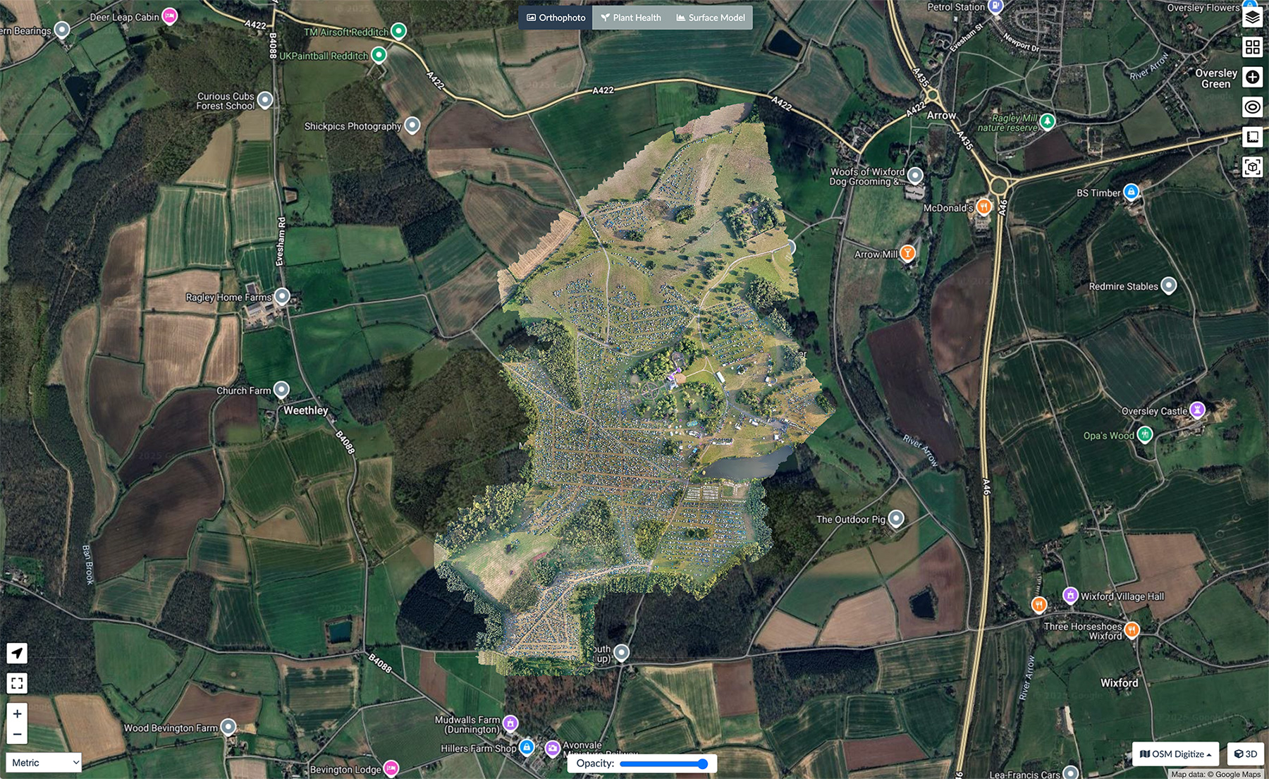
Mapping Land and Property Across the North West
We carry out drone mapping throughout the North West on construction projects, commercial land and private developments.
Flights are planned around the site layout and flown in a structured pattern. Images are captured at consistent intervals and then processed into mapped outputs using specialist software.
From this, we can generate 3D models, surface maps and measurable datasets. Some clients integrate the mapping results with laser scanning or existing survey work. Others use the aerial model on its own where that provides enough clarity.
Construction Progress and Ongoing Mapping
Drone mapping is often used on active construction sites at regular intervals.
Instead of relying purely on reports or isolated photographs, stakeholders can see how a site has changed between visits. Groundworks, material placement and footprint adjustments become easier to interpret when mapped from above.
It doesn’t replace day-to-day site management. It adds context.
Mapping Roofs and Complex Structures
Height and layout can make certain areas difficult to assess properly.
Mapping from the air allows roofs and elevated structures to be captured without arranging additional access equipment. The mapped output provides a reference that can be reviewed later, reducing the need for repeated visits just to check measurements or layout.
This can be particularly useful when planning maintenance or structural works.


Agricultural and Open Land Mapping
Large areas of land take time to walk and assess in detail. Boundaries, gradients and surface changes aren’t always obvious at ground level.
Drone mapping across the North West allows fields, buildings and surrounding terrain to be recorded in a single operation. The resulting data provides a consistent reference for land management, development or planning discussions.
3D Mapping and Digital Models
The imagery gathered during mapping flights is processed into structured digital models.
These models can support planning applications, reporting requirements or long-term records of a site’s condition. The value lies in the accuracy of the data rather than how it looks.
Drone mapping in the North West gives property owners, developers and land managers a clearer understanding of their site before decisions are made.
If you’re considering using drone services on an upcoming project, Portal Drones can help you plan things properly from the outset. We take the time to understand what you need, then capture the right information in a clear, practical way that’s easy to use long after the flight is finished.


 | FPV Drone Footage | Portal Drones, Cheshire")