With drone imagery, we can capture high-quality visuals of a site without disrupting work or putting anyone at risk. The end result is a clear snapshot of the site as it is, giving you something solid to look back on whenever you need it.

A Clear Picture of Your Site
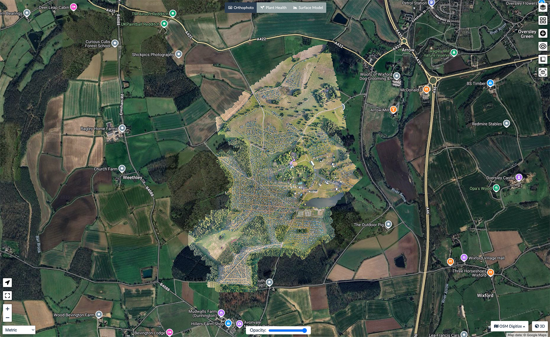
Using drones, we can get a clear look at roofs, boundaries, shared areas, and the general condition of a building without slowing anything down. The images give you a genuine record of how things looked at that moment, whether it’s before work starts or partway through a project.
Because everything is captured in high detail, you can review the visuals in whatever way works best for you — on screen, as exported files, or as part of a wider report.
It gives landlords, developers, and property professionals a clear view of what’s happening on site without needing to climb, measure, or take manual photos.
Get in touch

Useful for Owners, Landlords and Housing Teams
Whether you look after one property or a whole group of them, it helps to know exactly what condition they’re in. The images we capture make everyday decisions a lot easier — things like planning repairs, lining up future maintenance, or just keeping a proper record of how each place is holding up.
It’s also helpful when disputes arise. If damage is caused by contractors, tenants, neighbours, or third parties, having dated, unbiased imagery gives you a way to show what changed and when.
It’s a simple method of protecting yourself and reducing any uncertainty.
A Practical, Reliable Record from Portal Drones
Every survey we carry out is planned around the site and the access available. We gather the imagery, process the files, and deliver everything in a format that’s easy to view without specialist software.
We fly under the right approvals and insurance — CAA certified and listed with Drone Safe — so everything’s done properly and within the rules. If you only need a single survey, that’s fine, and if you’d rather have updates as the job moves along, we can work around whatever schedule you’ve got.
The aim is simple: give you a clear record you can trust and something solid to look back on when you’re making decisions about the property.
Get in touch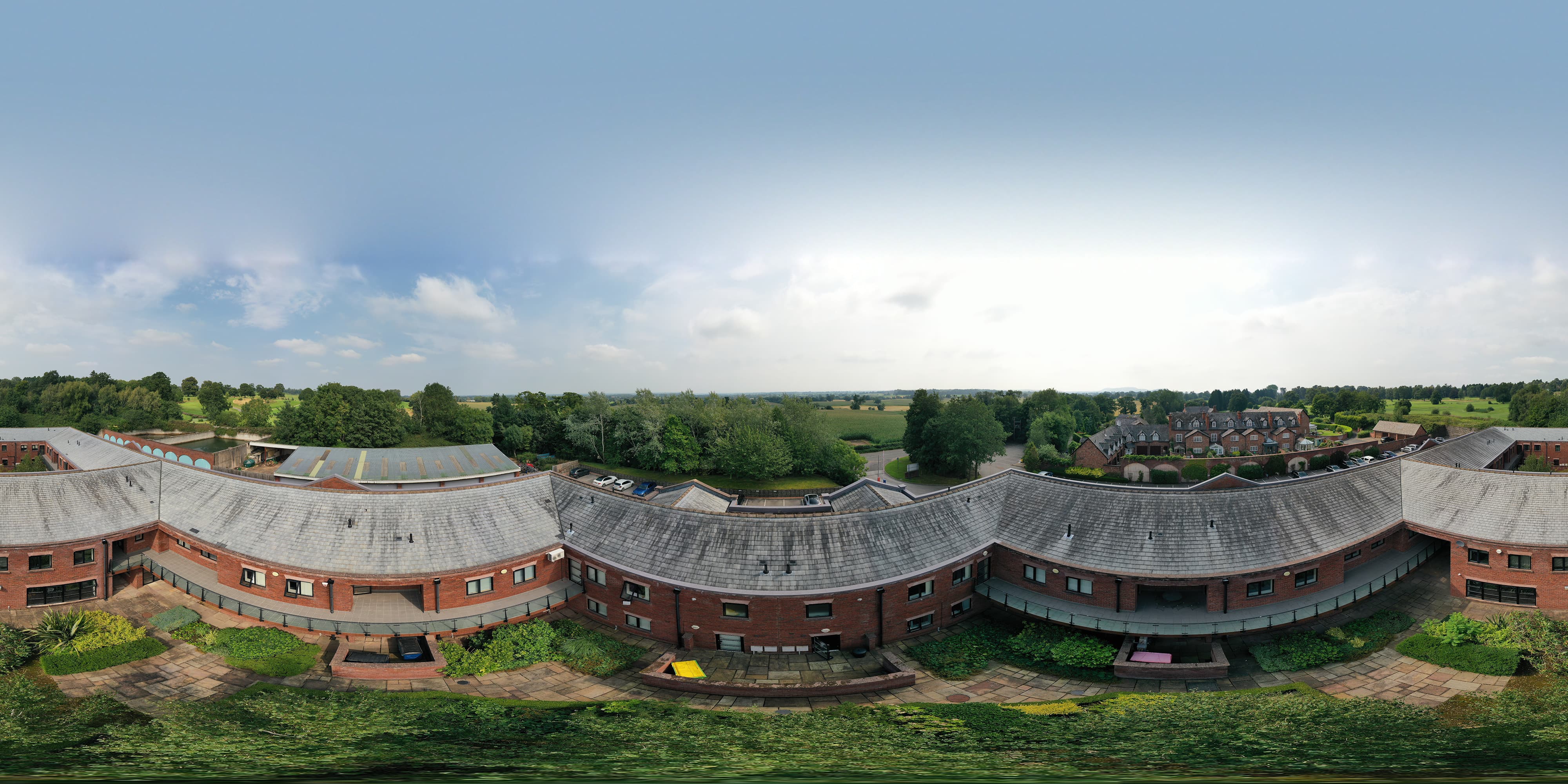
360° view from our drone showcasing a dilapidation survey — capturing every angle before any work had taken place, detailing the status of the roof on a month-by-month basis.